Multi-Sensor 3D Annotation Services (LiDAR + Camera + Radar)

Sensor Fusion Data Annotation Service – We Align and Label LiDAR Point Clouds, Camera, and Radar Feeds into Accurate 3D Datasets for AI-powered Perception Systems

Get in Touch

Built for Your Enterprise.
Powered by GenAI.
Designed by SunTec.ai

Multi-modal Data Labeling Services

The Right Solution for Every Sensor-Data-Capture Challenge

Single-sensor approaches leave your AI vulnerable to real-world conditions. Our sensor fusion data annotation services create the robust training data your models need to perform reliably across diverse environments and use cases.

We solve the prominent data capture challenges that sensors like LiDAR, cameras, Radars, GPS, or ultrasonic radars face (lighting, weather, or environmental interference), especially in fields like autonomous vehicles and robotics, where a comprehensive understanding of the surrounding environment is critical to AI performance. Our team handles data synchronization, sensor interactions, and 3D spatial relationships to create specialized training datasets.

The Challenge with Single-Sensor Systems

Individual sensors have blind spots that can compromise AI performance when it matters most:

  • LiDAR delivers precise distance measurements but struggles in rain, snow, or fog
  • Cameras provide rich visual detail but fail in poor lighting conditions
  • Radar works in all weather but lacks the resolution for fine object detection

Our Solution:Comprehensive Multi-Modal Annotation

We combine data from all your sensor modalities into precisely labeled training datasets that give your AI systems three critical advantages:

  • Maximized perception accuracy across all environmental conditions, ensuring accurate and dependable results
  • Complete spatial understanding of objects, locations, dimensions, movement patterns, size, and position within a 3D space
  • Improved detection reliability through cross-sensor verification that minimizes false positives and false negatives

Proven Expertise across Industry-Leading 3D Sensor Fusion Data Annotation Tools

Our team works with a broad range of industry-standard and proprietary platforms to deliver precise, production-ready training datasets. Whichever data labeling tools you prefer, this flexibility ensures that we can adapt seamlessly without disrupting your workflows, compromising accuracy, or delaying project timelines.

Multi-Sensor Data Annotation Services for Complex, Real-World AI Deployments

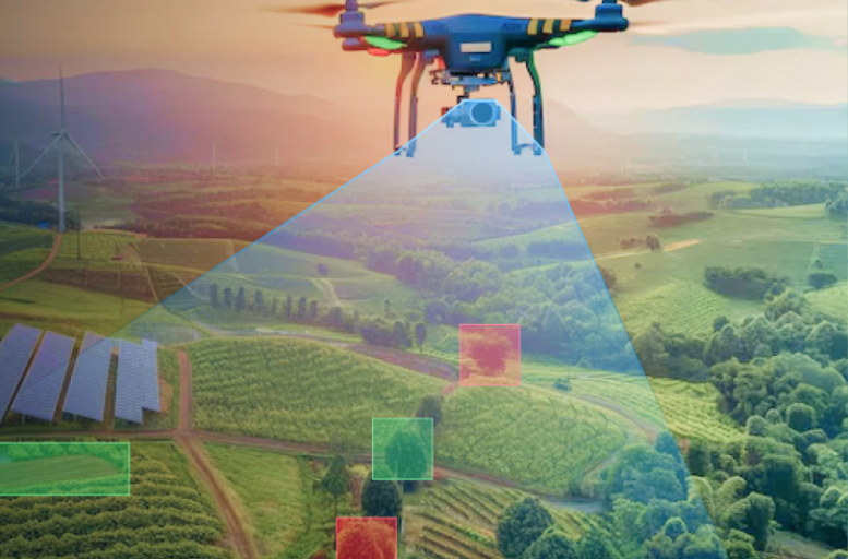
From autonomous vehicles navigating city streets to precision farming drones scanning vast fields, today's AI systems must interpret complex, ever-changing environments with exceptional accuracy. With multi-sensor annotation workflows, we power advanced AI applications across industries, delivering robust datasets required for safe, efficient, and scalable deployment.

Applications We Power with Multi-Sensor Annotation

Autonomous Navigation

  • Self-driving vehicles
  • Delivery drones
  • Warehouse robots

Industrial Automation

  • Manufacturing lines
  • Quality inspection
  • Material handling

Smart Monitoring

  • Traffic systems
  • Security cameras
  • Crowd management

Robotics & AI

  • Research platforms
  • Medical devices
  • Service robots

Retail

  • Smart checkout systems
  • Inventory automation
  • Customer analytics

Agriculture

  • Precision farming
  • Automated harvesting
  • Drone crop/livestock inspection

Don't Let Sensor Limitations Hold Back AI Performance

Our Sensor Fusion Data Annotation Services Deliver the Multi-modal Training Data Your Systems Need to Excel in Real-world Conditions.

Certified Expertise Backed by Strong Partnerships

Trusted by Leading Enterprises Worldwide

3D Sensor Fusion Data Annotation Services We Offer

Our advanced multi-modal data labeling capabilities address the full spectrum of spatial, temporal, and semantic requirements in multi-sensor datasets. From labeling objects in 3D space to handling different sensor types, like LiDAR, radar, and cameras, and their corresponding data formats, our services are purpose-built to enhance data reliability, strengthen model training pipelines, and ensure deployment-ready accuracy for complex, real-world AI applications.

2D–3D Linking & Sensor Synchronization

We align 2D camera imagery with corresponding 3D point cloud annotation data and synchronize data streams from LiDAR, radar, and other sensors. This ensures that every object is consistently identified across all modalities and timeframes, forming the foundation for accurate sensor fusion data labeling.

3D Cuboid Annotation

We create precise three-dimensional bounding boxes around objects like vehicles, pedestrians, and infrastructure elements to capture exact position, size, and orientation. This spatial data is vital for training AI perception models to recognize and interact with real-world objects.

Specialized LiDAR Annotation

Our team handles complex 3D LiDAR point cloud annotation for laser-based distance measurement data, producing precise object labels from dense point clouds. This helps power perception systems in autonomous vehicles, drones, and robotics.

Point Cloud Semantic Segmentation

We classify every point in a 3D dataset into specific categories, such as roads, vehicles, buildings, vegetation, and other scene elements. AI models trained on this granular, point-level labeling can achieve precise object detection and boundary definition and seamlessly integrate this spatial understanding into multi-sensor perception models like autonomous navigation, robotics, and advanced mapping.

Panoptic Segmentation

Our sensor fusion annotation service combines semantic segmentation (classifying each pixel or point by object type) with instance segmentation (identifying each individual object) to deliver complete scene understanding. This dual approach is critical for object tracking, movement prediction, and situational awareness in transportation, security, and industrial automation environments.

Polygon & Polyline Annotation

With precise polygons and polylines, we capture complex object boundaries and linear features, such as lane markings, road edges, and building outlines. In the context of sensor fusion data annotation, these techniques define irregular shapes and continuous paths with exact spatial alignment, enabling AI models to interpret environments accurately for navigation, mapping, and geospatial analysis.

Multi-Frame Tracking

We track and maintain consistent object identities across sequential frames, capturing movement patterns, speed, and trajectory changes over time. This temporal annotation enables AI systems to understand object behavior and predict future movements, supporting custom 3D sensor fusion dataset creation for autonomous vehicle behavior modeling, drone flight path planning, and real-time monitoring systems.

Bird's-Eye-View (BEV) Labeling

We transform complex 3D data into simplified 2D top-down perspectives, making spatial layouts easy to interpret. This bird's-eye view labeling is ideal for identifying drivable areas, designing navigation paths, managing traffic flow, and enabling safe route planning in autonomous vehicles, robotics, and smart city infrastructure.

Human-in-the-Loop Quality Assurance

We integrate human expertise into the quality assurance stage of multi-sensor fusion data annotation, ensuring that AI-generated labels are validated and corrected by trained specialists. This process catches edge cases, resolves ambiguities, and upholds annotation consistency across LiDAR, camera, radar, and depth sensor datasets.

3D Sensor Fusion Annotation Workflow – How We Deliver Deployment-Ready Data

Our multi-sensor 3D annotation services follow a structured, quality-driven process to turn raw LiDAR, camera, and radar inputs into accurate, application-ready training datasets. This workflow ensures your AI systems achieve maximum perception accuracy and perform reliably in diverse, real-world environments.

01

Data Preprocessing & Calibration

Raw sensor data is cleaned, aligned, and calibrated to maintain spatial accuracy across modalities.

02

Sensor Data Fusion

Synchronized sensor streams are merged into a unified 3D representation for comprehensive analysis.

03

Multi-modal Data Annotation

Objects are labeled with 3D cuboids, segmentation, and other techniques to capture accurate details.

04

Cross-Sensor Verification

Annotations are validated across sensor types to reduce false positives/negatives and improve detection accuracy.

05

Human-in-the-Loop Quality Assurance

AI-generated labels are reviewed and corrected by experts to ensure consistent, deployment-ready outputs.

06

Final Dataset Delivery

Production-ready multi-sensor datasets are delivered in custom formats for seamless AI model training.

Why Choose SunTec.ai for 3D Sensor Fusion Annotation Services

SunTec.ai brings field-tested expertise in high-precision data labeling, purpose-built for complex 3D sensor fusion workflows. Our global team delivers scalable, tightly synchronized annotations for multi-sensor datasets, applying domain-specific knowledge with human-in-the-loop QC to maintain accuracy across large-scale projects. Every engagement is backed by ISO 27001 and ISO 9001 certifications, CMMI Level 3 compliance, industry-specific standards like HIPAA, and an NDA-enforced workforce.

Calibration-Aware Labeling

We deliver perfectly aligned and synchronized datasets across LiDAR, camera, and radar feeds, reducing downstream model errors and rework.

Human-in-the-Loop Accuracy

Our workflows combine automated pre-labeling with expert human validation, ensuring both speed and uncompromising annotation quality with 99.95% accuracy.

Customizable Workflows

We design annotation pipelines around your specific sensors, formats, and output requirements, ensuring fit-for-purpose data delivery.

3D Annotation Expertise

Our annotators are trained in LiDAR interpretation, 3D point cloud labeling, and sensor fusion concepts, bringing proven domain knowledge to complex datasets.

Evaluate before You Commit

Get a No-Obligation Multi-sensor Annotation Sample

3D Sensor Fusion Data Annotation Services – FAQ Hub

Raw sensor data alone can't train reliable AI models because each modality has limitations — LiDAR struggles in rain or fog, cameras fail in low light, and radar lacks fine detail. 3D sensor fusion annotation services help you overcome these gaps by aligning and labeling multi-sensor inputs into a unified 3D dataset. This ensures your AI systems get complete spatial understanding, enabling accurate decision-making in real-world environments.

Yes. We can handle custom 3D sensor fusion dataset creation for highly specific use cases, like annotating underground mining vehicles with LiDAR + thermal cameras or drone sensor data fusion for agricultural crop inspection. Our annotation workflow adapts to your object classes, environmental variables, and required label formats, so your model learns exactly what it needs to perform in production.

In multi-sensor annotation, mismatched resolutions, coordinate systems, and frame rates can cause serious misalignment issues. We standardize all incoming LiDAR, radar, and camera feeds, handle their native data formats, and apply sensor fusion data labeling workflows that preserve both spatial and temporal integrity. This means your AI trains on data that actually matches the real-world conditions it will face.

Our sensor synchronization workflows correct timestamp offsets, align coordinate systems, and account for sensor latency. This ensures your annotated sensor fusion datasets have perfect temporal and spatial alignment, drastically reducing false detections.

Absolutely. We offer LiDAR annotation service with collaborative QA checkpoints. You can review 3D LiDAR point cloud annotation batches at defined intervals, suggest class or attribute changes, and approve before the next batch starts. This way, you retain full oversight while we handle the labor-intensive work.

Yes. Our teams operate in multiple time zones, supporting 24/7 project execution. This allows continuous progress tracking, faster turnarounds, and seamless coordination with global stakeholders, regardless of location.

We combine certified processes with strict security protocols to safeguard data and maintain quality:

ISO 27001:2022 – Protects sensitive multi-sensor datasets with enterprise-grade security controls.
ISO 9001:2015 – Ensures standardized, repeatable processes for consistent, high-quality annotation.
HIPAA Compliance – Secures healthcare-related and personally identifiable data.
CMMI Level 3 – Demonstrates mature, process-driven workflows ideal for scaling large, complex projects.

emailFree Sample
WhatsApp us